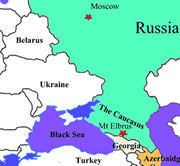
I have made two journeys to Elbrus. In 2001, I joined several European climbers whose trip was being facilitated by the same Russian organizer. It was a loosely run affair, but the mountain is not technical and doesn’t require a big team effort. We spent two days making acclimatization hikes above our main ‘camp’ at the Barrels Huts (roughly 11,000’) in preparation for a summit attempt.
However, as we moved above 17,000’ punishing winds forced our group retreat. Exhausted and discouraged, most of the team members elected to not to make another try. Overnight, the weather remained cloudy, but the wind seemed to abate.
Early the next morning, one young British climber, the Ukrainian guide, and I decided to attempt a single push of over 7,000’ directly from the Barrels Huts. We began climbing before dawn, took very few breaks and made surprisingly good time. The winds were calm, but it became increasingly cloudy, with little visibility.
By noon we had gained the saddle between the peaks, but the weather began to deteriorate and it started to snow heavily. After another hour, we had battered our way through increasingly deep snow to the volcano’s rim, but were now in a rapidly worsening storm and able to see only a few yards in any direction.
We knew we were somewhere on the summit cone, and our altimeter (air pressure based and only accurate to within a certain range) suggested we might be at the top, but with near zero visibility, we couldn’t physically locate the summit plaque or flags. As the snow continued to accumulate at a very high rate, we took stock of the increasing avalanche risk.
Ultimately, we decided to descend. Within a couple of hours, we punched out below the clouds into fading sunlight and back to base camp. I had mixed feelings. Even though we might reasonably make an argument for having summited, (I thought of it as the “Elbrus asterisk”) I knew that I would be back.
So, in 2004 as I began a year long sabbatical to finish the Seven Summits circuit, Elbrus was again on my list. Familiar with the details, I made the twelve thousand mile round trip as quickly as possible (flew three continuous segments, over two nights, from LA to London, Moscow and onward to Mineralnyie Vody).
Using the same Russian outfitter, I once again joined several European climbers, including my new friend Jacques Pirenne of Belgium. On a cloudless day, I retraced my steps of three years earlier. The summit was within easy sight of where my 2001 attempt had ended, perhaps 200 yards away and roughly 50 feet higher on a small knoll. But, this time I left with zero doubt and it was worth it.
[click to enlarge any photo] |

)
)
)
)
)
)
)
)
)